![]()
About
Andrew director of Spatial Collect has been operating Static and Mobile Laser scanning systems for over 8 years. Andrew’s knowledge in the use of LiDAR systems is expansive and started when LiDAR systems were only very new in Australia. Spatial Collect operates a Revolution 120 laser scanner from LiDARUSA. This small yet powerful scanner provides exceptional results that outperform’s any other scanner in its class. Mounted to the Innoflight Andrometer drone, Spatial Collect can capture accurate survey grade data with minimal control targets. Laser scanners unlike photogrammetry have quick processing turn around time’s and produce higher density point clouds. Higher density point cloud are a game changer when scanning areas with think vegetation. Density becomes a key feature when filtering point cloud’s to produce Digital Terrain Models.
System
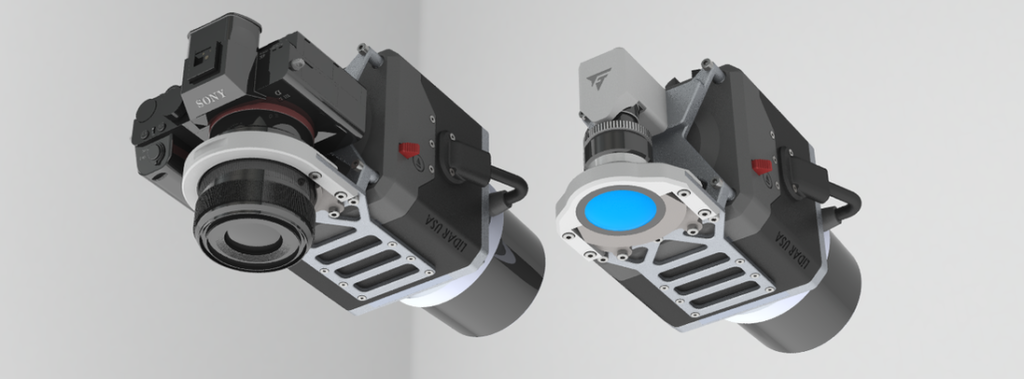
The Revolution 120 LiDAR system enables highly accurate terrestrial survey, land surveying, and topographical mapping of large areas in a non intrusive manner. Ideal for green field sites, volumetric survey during construction or land surveying. LiDAR laser scanning is the fastest and most affordable way to survey difficult terrain. Spatial Collect can deliver terrain data in a number of practical formats, including LAS/LAZ laser point clouds, 3D models, DXF vector files, ground contours, TIN, etc. For more information on the Revolution 120 and the range of scanners we use visit: https://innoflighttechnology.com/lidarusa/
Procurement
Spatial Collect is available to travel anywhere in Australia or New Zealand to undertake scanning works. For local government Spatial Collect can be procured under the Local Buy panel for Asset Management Services.
Free LiDAR Viewer by LiDARUSA: http://mypointclouds.com/
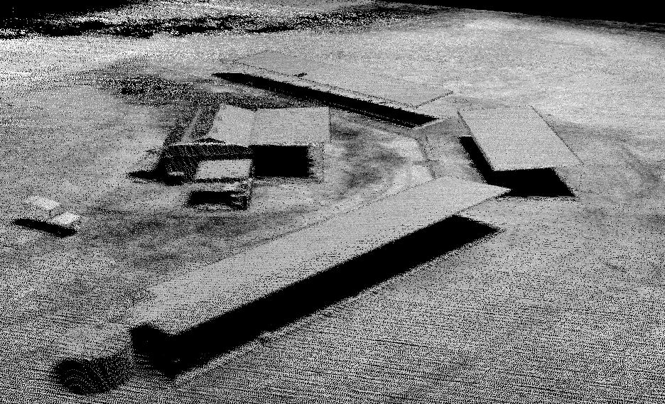
Below is a multi-pass LiDAR Scan from a Drone. Density is approx 190pts/sqM. No filtering has been undertaken.